 |
|
||
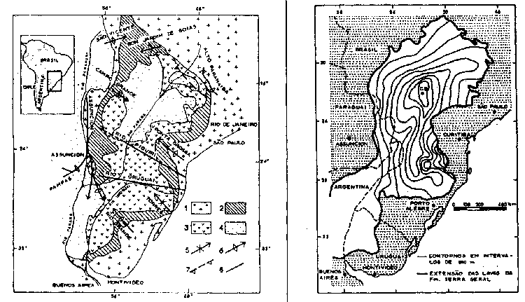
Figure 1. Geologic maps of the Serra Geral: (a) Location of the Parana Basin (after BELLIENE et al., 1986a): 1 - Crystalline Basement; 2 - Prevolcanic sediments; 3 - Serra Geral Formation; 4 - Postvolcanic sediments; 5 - Synclinal structure; 6 -Anticlinal structure; 7 - Folds; 8 - tectonic and/or magnetic lineations;
(b) Isopachs and areal extent (after ZALAN et. al., and PEATE et. al., 1988): CB - Borehole (2-CB-1-SP) in Cuiabį, Paulista, SP.